Blacks Creek Discharges
Blacks Creek Discharges
Project Details
| Original Construction Year | |
| Most Recent Rebuild Year | |
| Total Cost | 0.00 |
| Total Capital Cost | $0.00 |
| Latitude / Longitude Method | Google Earth/Maps |
| Latitude | 41.172807 |
| Longitude | -79.920091 |
| Elevation |
| Project | Blacks Creek Discharges |
| Project Type | Site Assessment & Restoration Plan |
| Project Status | |
| AMD Source | Oil/Gas Well, Refuse, Surface, Underground |
| Stream | Blacks Creek |
| Watershed | |
| River Basin | Ohio |
| Quad | |
| City/Township | Irwin |
| County | Venango |
| State | PA |
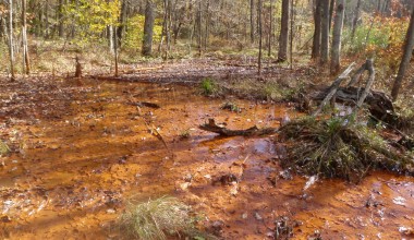
Description: This project compiles the data for abandoned mine discharges located in the Blacks Creek watershed, which is a sub-watershed of Slippery Rock Creek. The data has been compiled from the Watershed Implementation (Restoration) Plan and other related projects. Other related data can be found within the <a href="http://www2.datashed.org/blacks-creek/">Blacks Creek</a> stream project and several passive treatment projects located within the watershed including <a href="http://www2.datashed.org/bc16/">BC16</a> , <a href="http://www2.datashed.org/bc19-19b/">BC19 & 19B</a>, and the <a href="http://www2.datashed.org/mcintire/">McIntire</a>.
no data available
|
Map GPS Directions |
| Contact Person: |
| Contact Organization: |
| Project Designer: Cliff Denholm |
| Project Designer Organization: |
| Project Responsible Organization: |
no data available
no data available
| Project Performance |
|---|